Building Detection
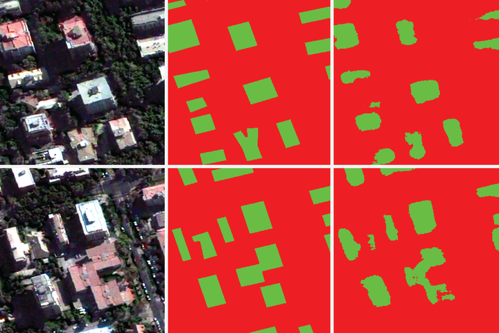 Raw, ground truth, and CRF prediction.
In this project we used a densely connected graphical model to detect building rooftops in satellite imagery. The problem was formulated as a pixel-level image segmentation task. Labeled building data was pulled from OpenStreetMap and registered to publicly available satellite imagery using standard GIS techniques.
We applied a fully connected conditional random field (CRF) defined on the complete set of pixels of an image as proposed by Krahenbuhl and Koltun, with unary potentials derived from Shotton et al.’s TextonBoost. Inference in this model is made tractable by using mean-field approximation and Gaussian kernels for the pairwise potentials, allowing for an efficient message-passing algorithm.